
 25 Oct 2026
 9 min read
A useful Kilimanjaro route map with airports and trailheads connects three parts of your trip: the airport, your overnight base and the park gate where your climb begins. Understanding how they fit together helps you compare route access, allow time for arrival rest and ask better questions about transfers.
Kilimanjaro is in northern Tanzania, close to the Kenyan border. For a wider overview of the region, see our Mount Kilimanjaro location guide for first-time visitors. This guide focuses on reading a map of Kilimanjaro for travel planning: where the main routes approach the mountain and how Moshi, Arusha and Kilimanjaro International Airport connect to them.
How to read a Kilimanjaro route map with airports and trailheads
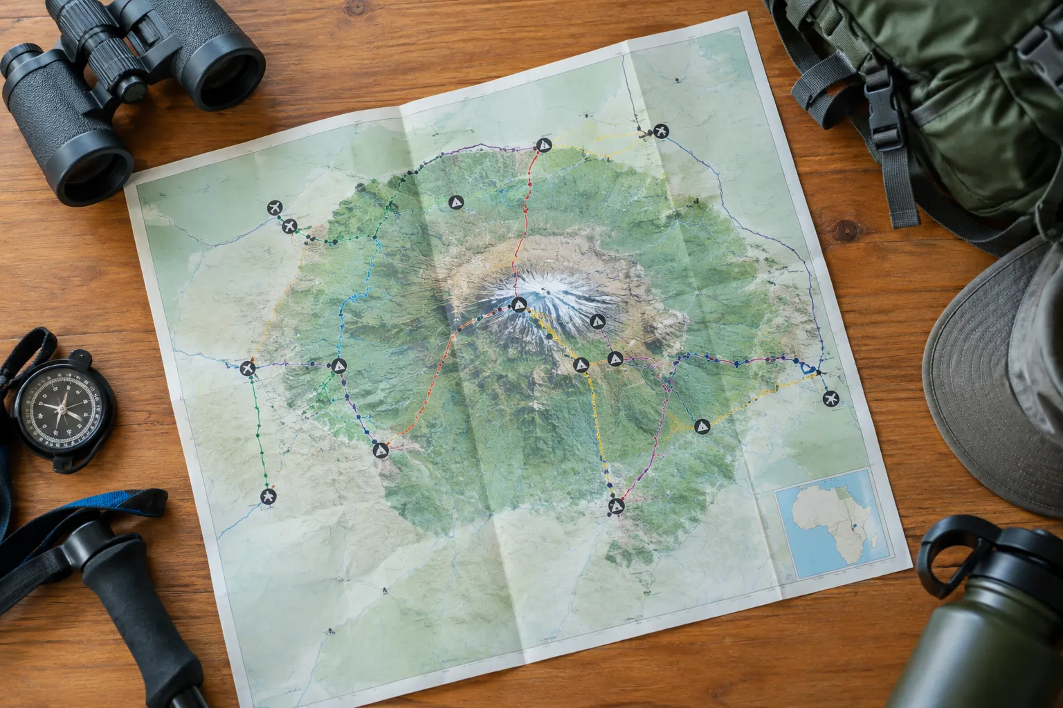
A regional map shows the mountain in relation to towns, roads and the airport. A route map adds the park gates and the paths used by climbers. Together, they help you understand the geography of Mount Kilimanjaro in Tanzania without mistaking a town or airport for a trailhead.
Map styles differ. Some show only the main route lines; others include camps, elevation contours, roads or park boundaries. Use a regional map to plan arrival and transfers, then check a current route itinerary for the walking stages and overnight stops.
Locate the mountain, towns, airport and park boundary
On a Tanzania Kilimanjaro map, look first for the mountain, then find Moshi, Arusha and Kilimanjaro International Airport (JRO). Moshi lies near the mountain’s southern side. Arusha is farther west, while JRO is between the two towns and serves as a common arrival point for climbs in the region.
The park boundary surrounds the mountain’s protected area. Route lines generally begin at a gate on or near this boundary, not in Moshi or Arusha. Roads connect the towns and airport to the gates, but the drive is only the first part of the journey: walking begins at the trailhead.
A map of Kilimanjaro can be useful for orientation, but it is not a transfer schedule. Distances measured in a straight line do not account for road layout, traffic, weather or pickup arrangements. For routes and access points together, see our Mount Kilimanjaro map of routes, parks and access.
Follow each route from its trailhead to the summit
On a Mount Kilimanjaro map, trace a route from its gate toward the high point rather than judging it only by where it starts. The Lemosho route approaches from the west and joins the southern side of the mountain. Machame also approaches from the southwest before continuing toward the summit area.
The Northern Circuit begins in the west and makes a broad arc around the mountain’s northern slopes. Rongai approaches from the north, while Marangu climbs from the southeast. The routes meet near the upper mountain, but their starting locations, itineraries and descent arrangements differ.
Map lines can simplify a complex trek. They may not show every camp, rest day or change in elevation. Compare the line with a day-by-day itinerary before deciding which route suits your available time and acclimatization needs. Our guide to five Kilimanjaro routes on a map explains how the paths relate to one another.
Where Kilimanjaro’s gates and route corridors sit
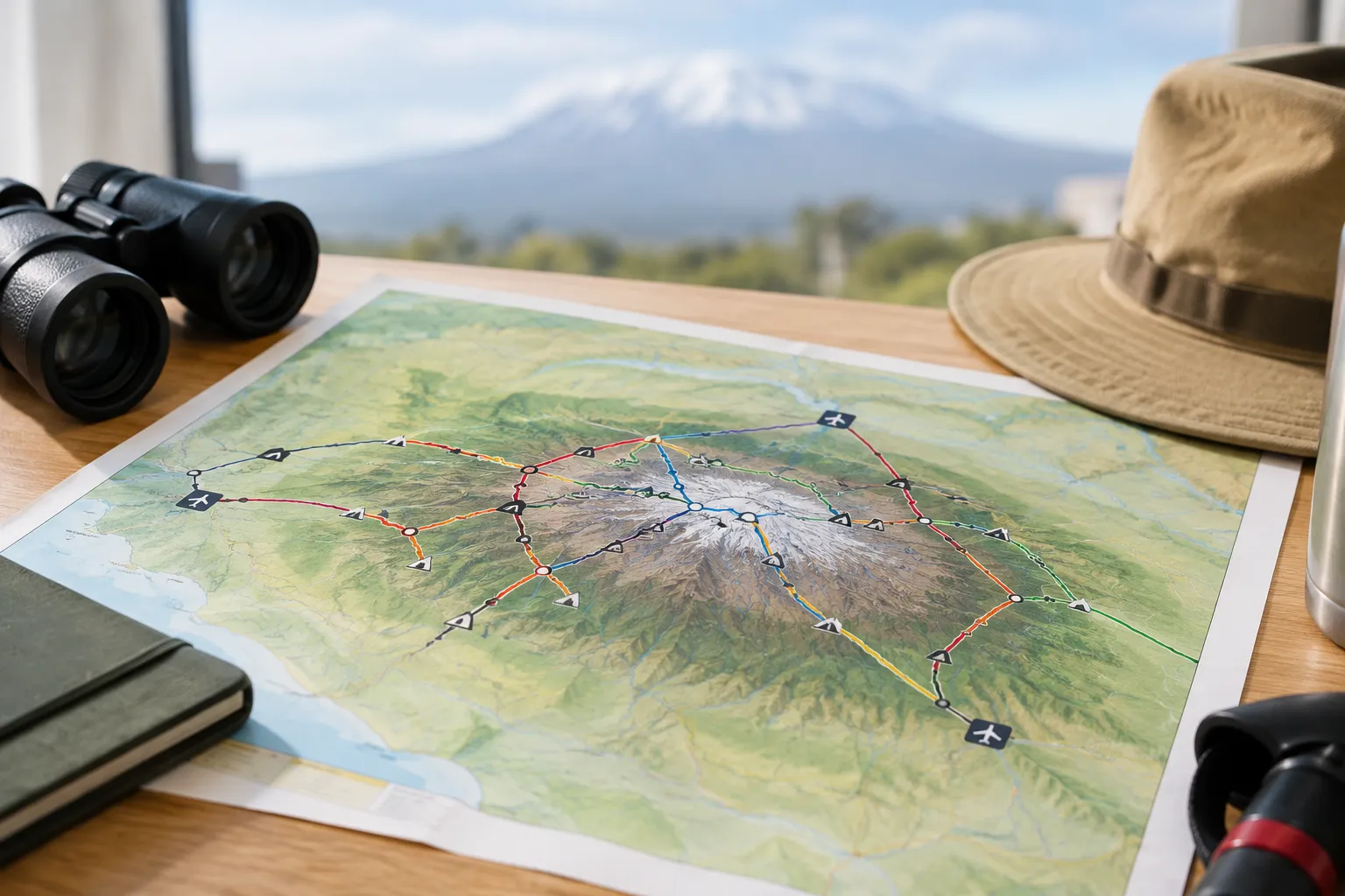
The gates are spread around different sides of the mountain, so route choice affects the direction and length of the drive from your base. It can also determine which roads your transfer uses. A map makes these differences easier to see, but the operator should confirm the actual pickup, gate and return arrangements for your itinerary.
| Route | General approach | Map location to look for |
|---|---|---|
| Lemosho | West, then toward the southern slopes | Londorossi area |
| Machame | Southwest and south | Machame Gate |
| Northern Circuit | West, then around the northern slopes | Londorossi area |
| Rongai | North | Nalemoru area |
| Marangu | Southeast | Marangu Gate |
The table is an orientation aid, not a complete itinerary. Routes can share sections of trail, and the descent may use a different side of the mountain from the ascent.
Western and southern approaches
Lemosho starts on the western side, reached through the Londorossi area. Its route crosses toward the southern slopes, where it connects with trails used by other itineraries. Machame starts farther south at Machame Gate and climbs through the southwest side.
These routes offer different ways to approach the mountain, even though both eventually enter the broader southern route corridor. On a map, note not just the gate but the direction the route takes after the first stage. That gives you a better sense of how the climb unfolds than comparing trailhead locations alone.
Northern and eastern approaches
The Northern Circuit shares its western access area with Lemosho before continuing around the northern side. Rongai begins in the north near the Kenyan border, giving it a different starting direction from routes that approach from the south or west.
Marangu approaches from the southeast through Marangu Gate. Its ascent and descent use the same general corridor, unlike several other common itineraries that descend by a different route. These geographical distinctions can affect transfer logistics and the landscapes you pass through; they do not, by themselves, establish which route is easiest or safest.
How Moshi, Arusha and JRO connect to the trailheads
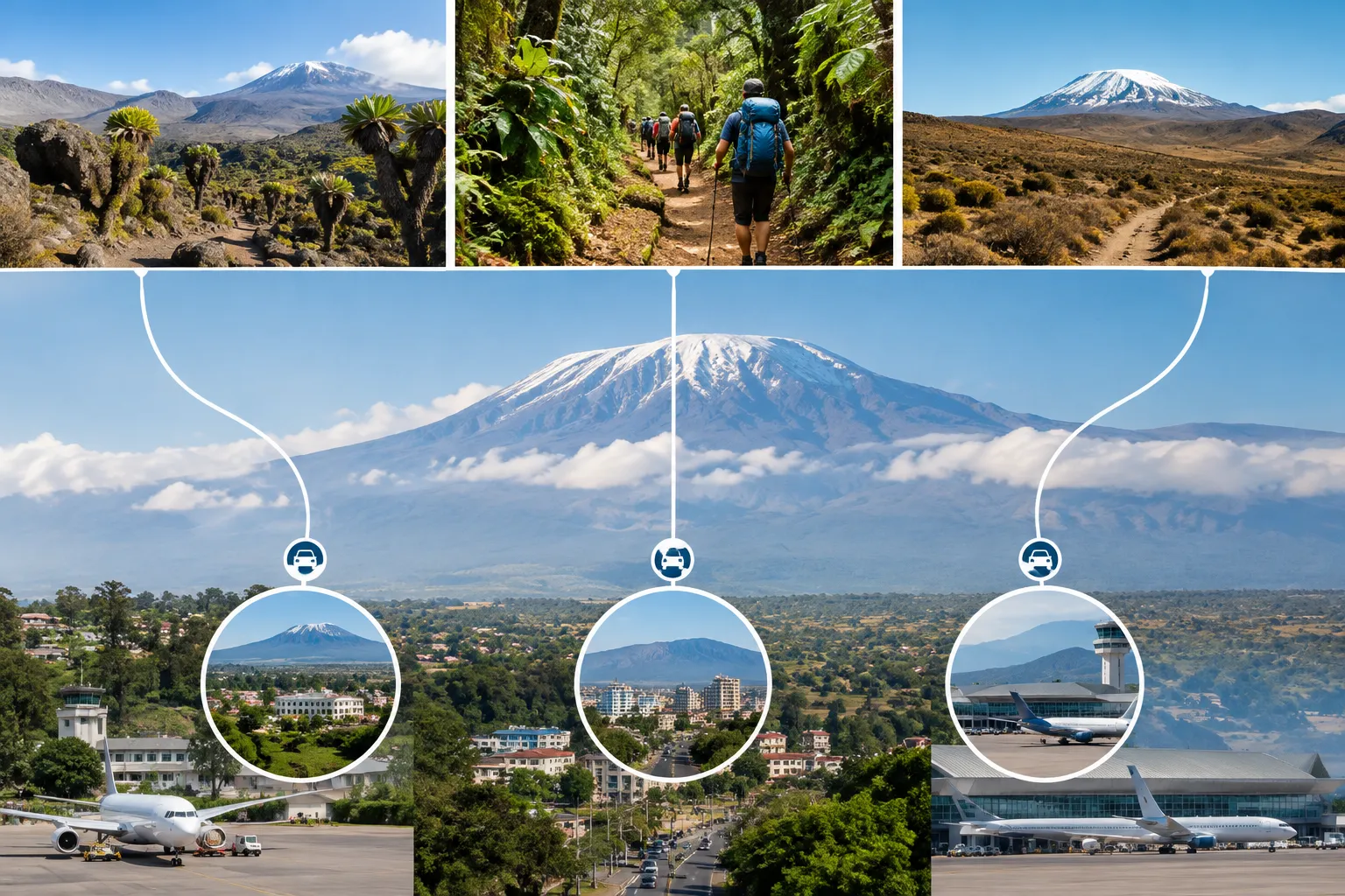
Kilimanjaro International Airport is the main regional airport to locate on a map when planning a climb. Moshi and Arusha are common overnight bases, but neither is itself a trailhead. From your base, a road transfer takes you to the gate for your chosen route.
The route you select affects which gate you need and therefore the transfer plan. When comparing itineraries, check where the first trekking day begins, where the climb ends, how you return to your base and whether airport pickup is included or arranged separately.
Choose an arrival base for your climb
Moshi is close to the mountain’s southern approaches, while Arusha is a larger regional base farther west. Which town makes more sense depends on your route, flight timing, accommodation plans and transfer arrangements. Do not assume that staying in one town automatically means a shorter drive for every trailhead.
Ask where you will sleep before the climb and how you will get to the gate the next morning. If you arrive after a long flight, a planned night’s rest can make the first transfer less rushed. Confirm whether your accommodation, airport pickup and gate transfer are part of the same arrangement or separate costs.
Plan the drive from JRO to your route’s gate
The drive from JRO varies with the trailhead, pickup point, traffic and road conditions. A map helps show the direction of travel, but it cannot reliably predict the time needed on a particular day. Ask your operator for the planned pickup time, expected transfer sequence and what happens if your flight is delayed.
Check the baggage details for your international and connecting flights, too. Some itineraries require a traveler to collect and recheck bags during a connection. Build enough time into your arrival plan for immigration, baggage collection and the transfer to your hotel rather than assuming the flight arrival time is the time you will leave the airport.
What route geography means for scenery and acclimatization
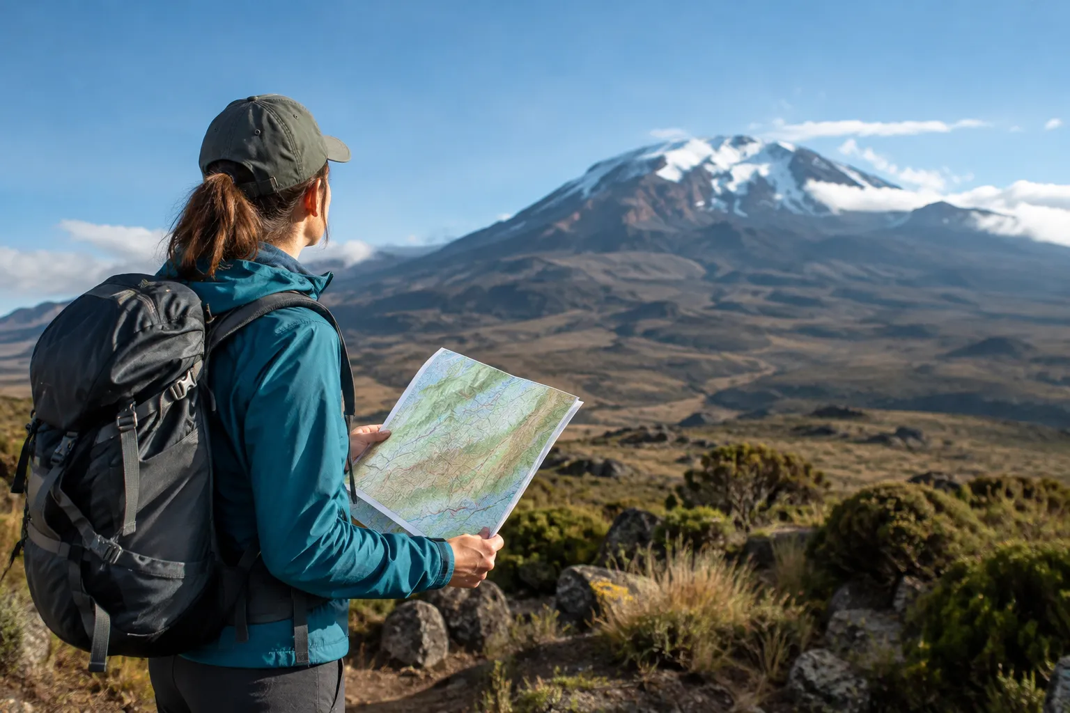
A route’s position on the mountain influences which slopes and environments you cross. Its itinerary also affects how many days you spend gaining altitude and how the daily walking profile changes. A map can help you compare direction and distance, but acclimatization depends on the full itinerary and your individual response to altitude.
For a broader comparison of route choices and preparation, see Climb Kilimanjaro: route options and preparation.
Compare landscapes across the mountain’s slopes
The western, southern, northern and southeastern approaches take climbers through different parts of Kilimanjaro. As routes climb, the surroundings change from lower forested slopes toward open, high-altitude terrain. The exact experience depends on the route and daily itinerary, not just the line drawn on a map.
Lemosho and Machame approach from the west and southwest before traversing the southern slopes. The Northern Circuit spends more time on the northern side, while Rongai begins there. Marangu follows a southeastern corridor. If scenery matters to you, compare the daily route descriptions and camp locations, not only the first trailhead.
Use route profile and duration to assess acclimatization
Route duration is one useful factor to compare because a longer itinerary can provide more time on the mountain, but days alone do not guarantee that a person will acclimatize well. Look at the elevation gained each day, the high points reached, sleeping elevations, rest days and how the itinerary allows for gradual adjustment.
A map may show elevation contours or route length, but it cannot predict how your body will respond. Ask how the guide team monitors health during the climb and what the plan is if a climber becomes unwell. Daily health monitoring and route acclimatization are practical safeguards, not promises of a summit outcome. If you have a medical condition or concerns about exercising at altitude, consult a qualified healthcare professional before travel.
Turn the map into a practical arrival plan
Use the map as the start of a checklist, then confirm each detail with your climbing operator:
- Mark JRO, your overnight base and the gate for your chosen route.
- Confirm the pickup location, transfer plan and whether airport pickup is included.
- Check the first trekking day, the climb’s final gate and the return transfer.
- Allow time to reach your accommodation, sleep and prepare before the climb.
- Review the itinerary’s duration, elevation profile and daily health-monitoring process.
- Check what is included in the quoted price, including transfers, accommodation, park fees, meals and equipment arrangements. Confirm which costs, such as international flights, personal gear and tips, remain your responsibility.
These questions help make the total trip cost clearer. Ask for inclusions and exclusions in writing rather than relying on a headline price, and clarify tipping expectations before departure. If responsible porter treatment matters to your decision, check the company’s KPAP partnership status and ask how porter welfare is addressed on the climb.
Kilimanjaro Map and Arrival FAQs
Is Kilimanjaro International Airport the same as JRO?
Yes. JRO is the airport code for Kilimanjaro International Airport, the regional airport commonly used by travelers heading to Moshi, Arusha and Mount Kilimanjaro.
Which airlines fly to Kilimanjaro International Airport?
Airlines and flight routes serving JRO vary by season and schedule. Check current airline timetables and your full itinerary, including connection points and baggage arrangements, before booking.
How many days before a Kilimanjaro climb should I arrive in Tanzania?
For most travelers, arriving at least one day before the climb allows time to reach the hotel, rest and prepare; allow more time if your flights or connections make delays a concern.
Can a climbing company arrange airport pickup and trailhead transfers?
Many climbing operators can arrange transfers, but inclusions differ. Confirm whether your quoted plan covers JRO pickup, the hotel-to-gate drive and the return transfer after the climb.
Is public transport available from Moshi or Arusha to Kilimanjaro trailheads?
Public transport operates in the region, but it may not provide a direct or practical connection to your specific gate with trekking baggage. Confirm transport options and timing before relying on it for a climb.
Can road conditions affect access to a Kilimanjaro trailhead?
Yes. Weather, road conditions and traffic can affect transfer times, particularly on roads serving more remote access points. Ask your operator about the planned route and pickup timing.
Can I combine a Kilimanjaro climb with a Tanzania safari?
Yes. A climb can be planned alongside a Tanzania wildlife safari, but the sequence and extra nights depend on your flights, climb itinerary and safari plans. Leave time to rest after the trek when building the schedule.
Should I book my airport transfer before or after choosing a climbing route?
Choose the route first, then confirm the transfer, because each route uses a different gate and may need a different pickup plan. If booking flights early, check your intended route and arrival logistics with the operator before finalizing dates.
Choose a route and confirm your transfer plan
A Kilimanjaro route map with airports and trailheads is most useful when you connect the geography to your actual travel dates. Compare the route’s starting side, duration, daily elevation profile and transfer plan—not just the line toward the summit.
Eco Africa Climbing offers guided climbs on the Lemosho, Machame, Northern Circuit, Rongai and Marangu routes, as well as group and private climbing options. If you are comparing itineraries, ask how your preferred route connects to JRO, where you will stay before the climb and which transfer costs are included.
Sedrick Silayo is a Web Developer and Digital Marketing Expert at Eco-Africa Climbing, with over 10 years of experience in Tanzania’s adventure travel industry. He specializes in Kilimanjaro trekking and Northern Tanzania safaris, sharing practical expertise on trip planning, mountain preparation, safety, KPAP standards, and safari experiences.